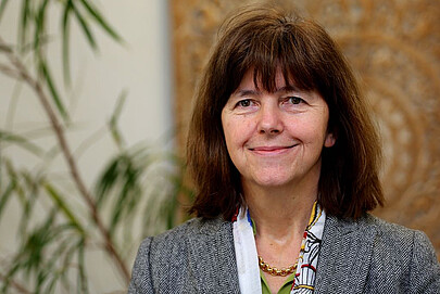
Prof. Dr.-Ing. habil. Monika Sester


30167 Hannover


Curriculum Vitae
-
Career
September 1961: Born in Gengenbach
1981 - 1987: Study of Geodesy at the University of Karlsruhe, Degree: Diplom-Vermessungsingenieur (Dipl.-Ing.)
1987 - 1988: Researcher at Institute of Photogrammetry und Remote Sensing of the University of Karlsruhe
1988 - 1994: Researcher at the Institute for Photogrammetry of the University of Stuttgart in the Collaborative Research Center 228 'High-precision Navigation' with Prof. Dr.-Ing. F.Ackermann and Prof. Dr.-Ing. D. Fritsch
1994 - 2000: Head of the Research Group 'Geo-Information Systems' at the Institute of Photogrammetry
24.02.1995: Doctorate (Dr.-Ing.) at the Faculty of Civil Engineering and Surveying of the University of Stuttgart; dissertation topic: Learning Structural Models for Image Analysis; Supervisors: Prof. Dr.-Ing. Dieter Fritsch, Prof. Dr.-Ing. Wolfgang Förstner
28.07.2000: Habilitation with the topic: 'Scale-dependent representations in digital spatial databases'. Supervisors: Prof. Dr.-Ing. Dieter Fritsch, Prof. Dr.-Ing. Wolfgang Möhlenbrink, Prof. Dr.-Ing. Lorenz Hurni.
October 2000: Granting of the Venia Legendi for the subject 'Geo-Information Systems
Since November 2000: Professor and Head of the Institute of Cartography and Geoinformatics at Leibniz University Hannover
2015-2018: Vizepräsidentin für Internationales der Leibniz Universität Hannover
-
Leadership in national and international committees
2001-2016: Speaker of the Centre for Geo-Information Systems for Spatial Decision-making Processes in Coastal Zone Management (GIS Centre) at the University of Hannover
Since January 2002: Chair of the Hanover Section of the German Society of Cartography (DGfK)
Since 2002: Chair of the annual AgA conference
2002-2009: Head of the Working Group Geo-Information Systems of the German Geodetic Commission (DGK)
2004-2008: Head of Working Group II/3 of ISPRS 'Data Generalization and Data Mining
2008-2012: Head of the Working Group II/2 of the ISPRS Multiscale Representation of Spatial Data
2012-2016: Head of the Working Group II/8 Mobility: Tracking, Analysis and Communication
2016-2019:
Vice President of the International Cartographic Association (ICA icaci.org)
Since 2016: Speaker (with Prof. Francois Holtz) of the research initiative, now of the Research Center FZ:GEO, https://www.geo.uni-hannover.de/
Since 2018: Chair of the DFG Senate Commission Earth System Research
2017-2018: Member of the Helmholtz Senate Commission "Earth and Environment".
Since 2018: Member of the Senate of the Helmholtz Association
-
Member in associations
Since 2002: Member of the German Geodetic Commission (DGK)
2003 - 2007: Member of the scientific advisory board of the GeoForschungszentrum Potsdam
2004-2011: DFG Review Board Member for Geophysics and Geodesy
Since 2004: Member of the Executive Board of the German Society for Photogrammetry and Remote Sensing
Since 2006: Member of the Braunschweig Scientific Society (BWG)
Since 2008: Member of the DFG Senate Commission "Geokommission" (German Research Foundation)
Since 2008: Member of the Geotechnologies Coordination Committee
Since 2009: Member Acatech
