Laser Scanning
-
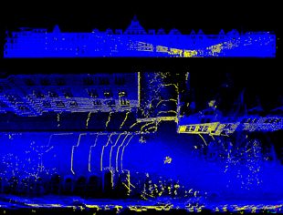
Mobile Mapping BikeThe ikg Mobile Mapping Bike is a supplement to existing mobile mapping systems such as those used at the Institute of Cartography and Geoinformatics, which are traditionally mounted on a car or van. The cargo bike makes it possible to cover or develop remote, winding or inaccessible regions. But the Mobile Mapping Bike can also be used independently, not only to record the surroundings, but also to enrich various other measured values with georeferencing. It can also be used and reconfigured more easily for student projects, as no driving license is required and the software and hardware can be flexibly adapted.Led by: Schimansky, Wage, Golze, FeuerhakeYear: 2023Funding: InstitutsprojektDuration: fortlaufend
-
5GAPS - Lokalisierung“Lokalisierung von mobilen Objekten in 3D-Rasterdaten” Das Projekt 5GAPS entwickelt ein alternatives 5G-mobilfunkgestütztes, hochgenaues und um Eigenschaften erweitertes dynamisches Positionierungssystem auf Basis eines digitalen Zwillings des (halb)öffentlichen Raums in Form eines 3-D-Rasters und führt erste Proofs-of-Concept durch. Das Projekt wird mit verschiedenen Partnern aus Wissenschaft und Wirtschaft bearbeitet. Am Institut für Kartographie und Geoinformatik sollen dabei Aufgaben im Bereich der Erfassung, Verarbeitung und Visualisierung der hochdimensionalen Daten durchgeführt werden.Led by: Sester, MonikaTeam:Year: 2022Funding: Bundesministerium für Digitales und Verkehr, Förderkennzeichen: 45FGU121_EDuration: 2022-2024
![]()
![]()
-
Uncertainty Estimation of LiDAR Scene Semantic Segmentation (DFG i.c.sens)Despite the capability of advanced deep learning models to accurately assign semantic labels to LiDAR point clouds, there is a notable lack of methods for uncertainty quantification. However, the estimation of uncertainty is essential for assessing the reliability of any prediction, particularly for safety-critical systems such as autonomous vehicles that rely on real data, including LiDAR point clouds. These systems need not only to perceive their surroundings but also to quantify uncertainty to avoid over-reliance on potentially erroneous predictions. Two primary types of uncertainty are generally distinguished: epistemic and aleatoric. Epistemic uncertainty, which arises from the model itself, reflects the reliability of a model’s predictions, whereas aleatoric uncertainty stems from characteristics inherent in the data.Led by: apl. Prof. Claus BrennerTeam:Year: 2022Funding: DFG Graduiertenkolleg i.c.sens
-
Object detection in airborne laser scanning (ALS) data using deep learningIn partnership with the Lower Saxony State Office for Preservation of Historic Monuments, we are developing a method for automatically detecting archaeological objects in airborne laser scanning data. The type of objects to be detected are mainly those of interest by archaeologists such as heaps, shafts, charcoal piles, pits, barrows, bomb craters, hollow ways, etc. They could be point, linear, or areal objects. To this end, we are using deep learning techniques; namely, convolutional neural networks (CNNs) to classify height images from the region of interest. A combination of multiple (in most cases 5) CNN classifiers are then used to detect and localize objects of interest in a digital terrain model acquired from the region of interest.Team:Year: 2018Funding: MWK Pro*Niedersachsen
![]()
![]()
-
Collaborative acquisition of predictive mapsSelf-driving cars and robots that run autonomously over long periods of time need high precision and up-to-date models of the environment. Natural environments contain dynamic objects and change over time. Since a permanent observation of “everything” is impossible and there will always be a first time visit of the changed area, a map that takes into account the possibility of change is needed.Team:Year: 2017Funding: DFG-Graduiertenkolleg i.c.sens
![]()
![]()
-
3D object extraction of high-resolution 3D point cloudsNational Survey Departments acquire area-wide, controlled airborne laser scanning (ALS) datasets with different point densities, which are at least classified into ground and non-ground points. The Working Committee of the Surveying Authorities of the Laender of the Federal Republic of Germany (AdV) is discussing about an update cycle of 10 years for ALS point clouds. The national survey departments also acquire 3D point clouds from aerial images every 2-3 years with high overlapping ratios using a method called Dense Image Matching (DIM). Those DIM point clouds have a high point density, which is equal to the original aerial image resolution. In addition, those DIM point clouds also contain radiometric information from the aerial images, but only reconstruct the surface due to image correlation. This project is split into four distinctive topics.Led by: Sester, MonikaTeam:Year: 2017Funding: Forschungs- und Entwicklungsvorhaben zwischen den Landesvermessungsämtern Niedersachsen, Schleswig-Holstein und Mecklenburg-VorpommernDuration: seit 2017
![]()
![]()


