Development of a Mobile Web Application with Augmented and Mixed Reality Features

| Led by: | Feuerhake |
| Year: | 2024 |
Introduction
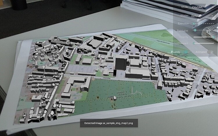
Augmented Reality (AR) and Mixed Reality (MR) are rapidly evolving technologies that provide new opportunities for the visualization and interaction with spatial data. Mobile devices, equipped with advanced sensors and cameras, make AR/MR accessible to a broad audience, enabling innovative applications in the geoinformatics domain. Here, typical use cases are:
- Navigation Assistance: Displaying geospatial data like pathways, landmarks, or points of interest as virtual markers in the user’s field of view.
- Site Analysis: Visualizing elevation models, soil data, or vegetation maps overlaid on real-world terrain.
- Urban Planning: Projecting future buildings or infrastructure onto the existing cityscape for visualization purposes.
- Environmental Monitoring: Overlaying pollution data or flood risk zones on real-world locations.
Despite recent advancements, challenges remain in determining the precise pose of the mobile device and accurately localizing virtual objects within the real-world environment. Addressing these challenges is critical for delivering effective AR/MR solutions.
The goal of this thesis is to develop a mobile web application featuring AR/MR capabilities using HTML, JavaScript, and other relevant web technologies. The application should leverage device sensors to determine the current pose of the phone (position and orientation) and localize virtual objects in the physical world.
Tasks
- Review of the existing work, relevant literature and technologies
- Development and implementation of a web-based mobile prototype including the design of a functional and intuitive user interface and the possibility for smooth interaction with virtual objects
- Conduction of an appropriate evaluation of the application, e.g., field test, …
- Writing the documentation and the report
Requirements
- Knowledge in the domain of web programming (e.g., HTML, JavaScript, CSS, …)
Contact
Dr.-Ing Udo Feuerhake (feuerhake@ikg.uni-hannover.de)
Institut für Kartographie und Geoinformatik, Appelstr. 9a, 30167 Hannover
